
Showing posts with label west java. Show all posts
Showing posts with label west java. Show all posts
Angklung, Indonesian Native Musical Instrument
Unesco to declare Angklung world heritage soon

Scientific and Cultural Organization (UNESCO) like batik, wayang, and the keris before.
Oray Tapa

These sights consist of a mixture of forest plants (pine, fir etc.). Existing water sources such as springs that are currently utilized for the purposes of visitors and the local community.
Potential visual landscape in the area of interest include natural forest, mixed forest plantations, views of the city of Bandung and the cool highland air.ourism activities in Oray Tapa is a camping and bathing in natural springs.
Curug Cimahi

These sights are used for daily tours. Daily tourism activities that can be done is a picnic area, cross country, take a bath in the vicinity of the waterfall.
Cimahi Curug name was taken from a time Cimahi which is not far from Curug, besides this Cimahi Curug water flowing into the city of Cimahi and used by locals for their daily needs. This water is clear so that both the drinking water used for cooking. That's why the waterfall is named "Curug Cimahi." At this location, we can not only enjoy the natural beauty around them. If we are sitting or standing on the edge of a waterfall pool, we can feel the cold splash of water on our faces.
Type of existing facilities are parking, gates, security fencing, location map, a path, picnic sites, shelters, benches, bins, information center and guard posts.
Jayagiri

These sights consist of a mixture of forest plants (pine, flower and so on). Existing water sources such as springs are currently used for the purposes of the visitors. There's also an interesting area as forest plantations and natural forest with mountain air.
Curug Cileat

In Kampung Desa Mayang Cibago Cultural Tourism in which there is potential for the daily life of society is still very strong traditional Sundanese, among others:
Curug Cibareuhbeuy

Highest rainfall between the months of October to March and a dry month in the months from July to September. Most of the steep topography and steep elevation of 1500 m above sea level.
These sights have a wealth of biological resources such as flora and fauna and its natural panoramic beauty that is a secondary forest dominated by stands of pine (Pinus merkusii).
Carita

Some tree species that found here are the Teak (Tectona grandis), Mahogany (Swietenia macrophylla), African Mahogany (S. khaya antoteca) and bungur (Lagerstromia speciosa). There are also experimental plantation forest research institute that is developing bud cuttings meranti (Shorea reprosula) and Shorea selanica.
Some animal are Carita Tando (Petaurista elegans), wild boar (Sus vitatus), long-tailed macaques (Macaca fascicularis), langur (Tachypitechus auratus), lizard (Varanus salvator) and python (Python sp).
Gunung Pinang

Potential landscape visually interesting enough to the location with natural landscapes such as: rice fields, settlements, while the natural phenomenon / visual potential landscape in the area that has distinctive characteristics is a mixture of forest plantations and views of the city off Peacock, Bird Island and the Mosque of Banten.
These sights are used for daily tours. Daily activities are carried out is a picnic, hiking.
Cibobos

This tourist place situated at an altitude of 0-3 m above sea level, configuration is generally flat to hilly field. This region has rainfall 3140 mm / year with temperatures 20-30 0 C.
These sights have an area of 3 ha of plantations (teak, mahogany, etc.), potential visual landscape into an interesting location with natural landscapes such as: coastal and high seas.
These sights are used for daily tours. Type of tourism facilities available in this region is the ticket office, shelter, toilets and garbage.
Telaga Remis

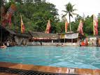
These sights are used for daily tours to the tourist activities that can be done is to picnics, boating, fishing, hot showers and kemakam sacred pilgrimage.
A growing legend in the community of West Java, based on those stories from their parents, who told generation to the next, that the lake mussels from Prince Salingsingan tears crying incessantly, while receiving advice (advice) from Prince Sutajaya, one The only trust the Sultan of Cirebon.
Blanakan

Places of Tourism is situated at an altitude of 0-1 m asl., The field generally flat configuration. This Kawaasan 1210 mm of rainfall per year, with average air temperature of 28oC. Natural scenery with coastal forests, and tourism activities that can be dressed daily fishing, camping and boating.
Captive breeding of crocodiles that have been developed since 1989, including one of the tourist area which attracted the attention of many tourists. Until now there are 236 estuarine crocodiles that used to be sent from Borneo.
In certain months (October-November) every year always held a traditional ceremony known fishermen with sea party, namely by removing the sacred ceremonial buffalo head out to sea.
Situ Sangiang

Tourism activities that can be taken include cross country, boating, fishing and camping.
In Situ Sangiang there is a sacred tomb. Mention the local caretaker, the tomb is in situ sangiang penggir this is one of the tomb figures of Islam spreaders in Majalengka and surrounding areas.
Naturally, when traveling in Situ Sangiang are more religious. Some come all the way over there, just wanted to make pilgrimages kemakam edge guardian and then a shower there. So really this tour is very sacred. According to the locals and the caretaker there was an incarnation of an ancient kingdom called the kingdom lake.
Gua Buniayu

Buniayu Cave tours are not only used for the daily also for camping tourism. Tourism activities that can be done is to search the cave, picnic, camping activities are available while for some of the camp complex.
Cave sights Buniayu Cipicung originally known as the Cave by the local community in accordance with a nearby village. Some scanner used to call it the Cave of the Demon, while Perum Perhutani himself as the manager has set a Buniayu Cave.
Cave Buniayu Penulusuran and mapping carried out for the first time in 1982 by a speleogiwan Indonesia - Dr. R.K.T. Kho, along with several members of the French surfer Federation Francaise De Speleleologie (FFS), namely: George Robert, Arnoult Seveau, Michael Chassier.
Curug Cigentis

Visual landscape into an interesting and challenging locations such as mountains and persawahandan township residents who are still traditional. Potential visual landscape in the area who have distinct characteristics with Curug and valleys in the forest with high species diversity, including trees Rasamala, Puspa, Kibanen and ferns, the types of pairs and types of bamboo.
Cigentis around the sacred places there are like-:
1. Place Jiarah At Mount prop Buana
2. Waterfalls with a bathhouse allegedly hereditary when a bath can be durable victorious here.
3. Places to eat great-grandmother who has a historical value in the Karawang regency, as based on the story secondhand tombs of saints.
Cibolang Pangalengan

These sights consist of forest plantations (calothyrsus and pine), situated at an altitude of 1450 m above sea level, configuration is generally flat and hilly ground. This region has rainfall 4000 mm / yr, the air temperature 23-250 C.
Existing water sources such as springs that exist in the form of hot water is currently utilized by making a shelter for drinking purposes and MCK. Potential landscape visually interesting enough to the location with the natural scenery of tea plantations and mountains, while the phenomena of nature / landscape visual potential in the area that has distinctive characteristics is the hot springs and craters.
These sights are used for daily tours. Daily tourism activities that can be done is a picnic area, hot showers and swimming.
Kamojang

This area is part of the slope of the cone of Mount Gandapura. Sloping hilly topography with steep slopes of the field, sloping undulating, except in the middle of the area which is actually a part of a truncated cone, so the situation is flat.
According to Schmidt and Ferguson's classification, Kamojang and surrounding areas including climate type B with an average rainfall 2000-2500 mm per year. The minimum air temperature 150C, a maximum of 25oC.
Nature Reserve and Area Kamojang has natural beauty, the air is cool and comfortable and its flora and fauna in it is beautiful scenery to be enjoyed. There are also several other craters that exist between Manuk Crater, Crater Berecek, Sorekat Crater, Crater Kamojang, Cikahuripan Crater, Crater Railway, Corner Crater, Crater Rain, Crater Panggilingan, New Crater, Crater Currently, Crater Cibuliran, Kawh Racung and others. Based on potential and existing field conditions in the area of Natural Park Kamojang, the nature tourism activities can be done is as follows:
Cipanas, Gunung Galungung
With prolonged eruption of Crater Mountain and Mount Warirang So since April 5, 1982, where it has been spit out tens of million cubic meters of waste material and Mount Apih causing major changes in the general condition of the area either directly or indirectly run private.
With the physical state of the forest has been transformed into a barren land, state land and the third part to be polluted and damaged areas of agriculture, animal husbandry, plantation, irrigation and irrigation-damaged social and economic circumstances surrounding communities of Mount Mersa anxiety, fear and future expectations that are not uncertain, especially for those directly hit by disasters.
Cangkuang

Cangkuang sights other than not only used for camping tourism. Tourism activities that can be done is a picnic area, cross country and hiking, camping activities are available while for some of the camp complex. In these places there is also a building cangkuang meetings and guest house.
Around the plant species there Cangkuang Damar (Agathis Loranthifolia) in 1982 and 1986.
Meeting House was triggered back there Cangkuang protected forests is limited by vegetation type puspa (Schima Walichil), Rasamala (Altingia excelsa), Saninten (Eugenia fastiqiata), Harendong cai (Medinela speciosa), Manglid (Magnalia blumairanti), Jamuju (Podocarpus enbikata BL), etc. .
Situ Gunung

Situgunung located at the foot of Mount Pangraga at an altitude of 950-1036 meters above sea level. Condition tofografinya small part flat, undulating to hilly.
Astronomically Situgunung area lies between 106 54'37 "- 106 55'30" east longitude 06 39'40 "- 06 41'12" south latitude.
According to Schmidt and has Situgunung Perguson climate type B. The average rainfall is 1611-4311 mm per year with 106-187 rainy days per year. Temperatures ranged from 160 C - 280 C and average humidity 84 percent.
Subscribe to:
Posts (Atom)